Tuesday, May 26, 2009

Following the Herd

DAY ONE HUNDRED AND FORTY SIX

Does anyone out there have any suggestions on getting me some sponsorship? I have so many wonderful hikes I'd love to do all over this beautiful country of ours but there's only one thing stopping me: I have to work to pay my bills. Because of that simple fact there are some of my hikes that are quite frankly just a bit boring, like today. Wouldn't it be great, though, if I could travel around the country, do incredible hikes along the way and get paid for it? I'd still post the pictures for you to enjoy and you could sense a certain amount of awe and wonder while YOU sit in your cubicle at work and read about all the great places I get to visit. So think about it and leave me any suggestions in the comments section.

Since I was going after work I couldn't be too picky. I had two things I required of a hike today. One, it had to be in the shade and two, it couldn't be on a road. So I headed to the "hiker's" hangout behind Palm Desert Target and headed up the start of the Hopalong Cassidy Trail. Most people who hike it think it is the Bump and Grind Trail but they would be wrong. Bump and Grind is the road. This new trail has a different name although it's not posted. There still is some sun on the trail but by the time I get up there it'll be gone so I'm good.

I'd only hiked this section of trail in the dark this year so this is my first time seeing it in full daylight. It's a well engineered trail, not too steep.

As it heads up the ridge, it gets a little steeper. It's not too bad, though. You can see where people have cut the switchbacks. It may not be a problem now but if we get a couple of good thunderstorms this summer, it's goodbye, trail. The erosion could be incredible.

It's a good thing I didn't choose the hike to the cross today; it's in the sun.

You get to a point where the trail traverses across the hill but that's so boring. I can only stay on the trail for so long. This canyon looks interesting, though.

Over to the left of the canyon I find this little trail. I guess I'm not the only one with this idea.

The trail peters out quickly and I end up having to climb some rocks. It won't be the first time or the last.

I think about going up to the top of B&G but decide against it because I'd have to walk the road and it looks like it's in the sun. I decide to go another way.

It won't be this way, though. I could go down this hill to the trail I came up but it's just a bit too steep and a bit too loose and a bit too rocky. I'll find another way.

After wandering around a little, I hit the trail and head back down. I still don't understand the popularity of this area but I think I have an idea that makes sense. While most people who come up here say they are hiking, they are not. They are working out, just like you'd do in a gym. In fact, the majority of the people here do not even wear hiking clothing or shoes but wear workout attire. I doubt very many of them have ever hiked another trail and that's OK. There are days when all I can do is follow the herd but on the days I want to get away from it I am happy that they won't be following me. I can't say I had a very good hike today but I did get an OK workout and some days that's all I can do. At least until I get a sponsor. Work on that for me, will ya?

Monday, May 25, 2009

Under A Rock

DAY ONE HUNDRED AND FORTY FIVE

Working for years in the hotel business has taught me that the best place to spend holidays is at home. Going somewhere means too many people, too much traffic, too little rest and relaxation. So what did I do today on Memorial Day? I packed the boys and a couple of their friends in our minivan and drove up to Idyllwild. Not only did I head out of town on the craziest driving day of the year, I went to one of the most popular trailheads in Southern California at Humber Park. Luckily for us, we left in the afternoon and got up to Idyllwild after the hoards had already left to return to suburbia.

Humber Park is the highest point you can drive to from Idyllwild on a paved road. It has two trails that lead from it: the Devil's Slide Trail and the Ernie Maxwell. The Devil's Slide Trail is basically your gateway to the San Jacinto Wilderness. It's 2 1/2 miles long and has about a million switchbacks. It generally also has about a million backpackers. I hiked out of the Wilderness on a Friday before Memorial Day one time and it was like walking against a parade. I'd never seen so many backpackers on one trail carrying so much stuff. Sweating, red-faced weekend warriors afraid to be without creature comforts were seen carrying lawn chairs, coolers and full size tents atop gigantic frame packs. It was a spectacle I'd never seen before or since. Ease of access brings out all kinds.

We, however, would not be taking the Devil's Slide Trail, at least not today. Our little stroll would be on the Ernie Maxwell Trail, a family friendly trail that traverses the hillside below Lily Rock. It is a wonderful trail for kids, as long as they can walk on their own.

The last time I did this hike my son, Nikolas, threw up all over me. He'd gotten car sick on the drive up and since he was just a baby at the time, he couldn't really tell us about his dizziness and discomfort. I put him straight into his baby backpack and hit the trail. The jostling from the pack brought him past the brink and I got a back full of regurgitated baby food and breast milk. It's no wonder I haven't been here since. The sound of my wife's laughter still echoes from the canyons above Idyllwild.

Humber Park is beneath the towering behemoth of Lily Rock. Climbers refer to it as Tahquitz which is the name of the peak behind it. Tahquitz was the training ground for many legendary Yosemite climbers like Royal Robbins and Yvon Chouinard. I've done a number of climbs on it myself although not recently. For non-climbers there is a non-technical route to the top but even it is still quite difficult. Most hikers just use the trail to Tahquitz Peak and leave the rock alone to the climbers.

We head down the hill toward the Ernie Maxwell Trail.

Just down the hill, we come to the creek in Fern Canyon, which is flowing quite nicely.

From the trail we get a nice view of Suicide Rock. This is another popular climbing area and may, in fact, be more popular. Most of the climbs on Suicide are shorter and don't require as much of a hike to get to them. There is also a hiker's path to get here and it's easier, too.

We come to this marker showing a climber's trail to Tahquitz. The trails to the base of the rock are steep and loose. I ask the boys if they want to hike up here but they decline.

This nice flat trail is more to their liking.

As entertainment on the trail, we occasionally stop and throw rocks. I choose this bark stripped snag as a target and show the boys that the old man can still wing a rock with the best of them. I hit it twice and no one else even hit it once.

As we made our way on the trail we noticed this trail heading downhill and wonder if it goes down to the creek. If it does, we can follow that back and make a nice loop.

Unfortunately, it just dead ends at someone's property.

So we pose for another group photo.

Then it is back up the trail to the main trail and back to the trailhead.

The hike was easy, relaxing and no one puked on me so I'd consider it a success. It also gets the kids familiar with the area so they won't give me a hard time the next time we come and try the other trail here. I just won't mention anything about the switchbacks.

Sunday, May 24, 2009

Rock Me Gently

DAY ONE HUNDRED AND FORTY FOUR

Today I only had a few things I was looking for in my hike. It had to be flat, close to home in the shade. After climbing some steep stuff the past few days I figured I needed a break. I was also going to take the dog.

I headed up to the Fred Wolff Bear Creek Nature Preserve and went west. The Preserve is certainly flat but there's not a lot there to see.

West of the Preserve, however, is a large alluvial fan that comes down from the steep canyons near Indio Mountain. I find a trail here.

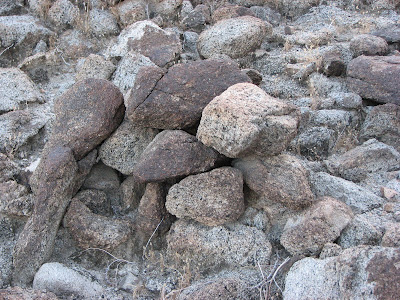
As the trail grows more faint, I find several of these rock piles to follow and stay on course.

There is a good chance that these are ancient Indian markers, at least some of them. The Cahuilla had a village site here in La Quinta and hunted and gathered all throughout these hills. According to various BLM reports, this area is high in potential "cultural resources".

I also come upon this little rock circle. This may or may not be a "cultural resource" but it seems like something interesting to me.

The trail becomes less distinct but there are a couple of these rock piles to guide me in the right direction. You have to look close to see them.

I quickly get to a place where I completely lose the trail. I could go back and try to locate it again but I don't have time so I just keep moving on.

Looking ahead I see some deep canyons but I really do not have time to explore them and won't until after summer is over. There may be several hours or days of exploration up here and who knows what I might find. The Cahuilla Indians called the area around Indio Mountain something like "No passageway" since there was no trail that led over the mountain ridge at this point. Ironically, the BLM is considering putting a trail in this area to connect Palm Desert and La Quinta although, in my opinion, there are better alternatives where trails already exist. Why an Indian trail reaches into this area is something to ponder. My guess is it's a hunting trail. If there was no passageway, then animals could be cornered and killed. I've seen a hunting blind on top of Indio Mountain and I suspect there may be one to two higher up in the canyon.

I move over to a big drainage in hope of finding a sandy wash I can follow back but I am met with this. I think I'll just have to go back the way I came.

While it's not really flat, it is certainly not steep. But I do not want to hike down this in the dark without a flashlight (or with one, to tell the truth) and so end my exploration here. I'll add to my list this as a place to explore further when the weather becomes conducive to it. You never know what you might find out here even if it's on a gentle slope full of rocks.f

Saturday, May 23, 2009

How Sweet It Is

DAY ONE HUNDRED AND FORTY THREE

This morning I had hoped to toss the kids in the car and take them to the mountains. Didn't happen. The kids slept late and I didn't have to heart to wake them up. By the time they got up, got dressed and got fed it was too late to follow my original plan. That's OK, though because at this point I'm able to adapt rather easily. Lucky for me; today's hike was great. I climbed a peak I'd never done for the first time and I love when I do that.

Sugarloaf Mountain is a little peak that rises above Highway 74 near Pinyon. I'd never done it because it never seemed far enough away or tall enough. What it lacks in those characteristics it makes up in wildness.

I start the climb from the turnout right across from the Cahuilla Tewanet Lookout area on Highway 74. I don't know why I didn't park in the lookout parking lot but I will next time.

When I left Palm Desert, the temperature was 100º. Here it is 82º and I will soon be in the shade. It's a perfect day for hiking.

It is also a perfect day for snakes. Fortunately, the only snake I see is this little garter snake. I walk slowly making sure I keep my eye out for rattlers every step.

While the flowers in the desert have all but disappeared, up here there are still blooms like this Silver Cholla.

Going is slow because in addition to keeping my eye out for snakes, I have to make my way through cacti, agave, loose rocks and other things that are designed to bring me misery.

As I get higher, the climb gets steeper but the plants become more sparse. I am grateful on both counts. I love climbing steep ground and I hate getting stuck all the time.

The view from up here is wonderful and the weather couldn't be better. A breeze is blowing and I actually feel a little chill. I like it.

After a bit more climbing I am at the top. I make my way to about three different little rock piles that all look about the same height. There is not summit register or benchmark to it's hard to tell. But I think this is the top.

There's a real nice view from here looking down at this rock ridge that comes off of the main mountain.

Looking the other direction, I can see Martinez Mountain, a peak I have climbed several times. I wonder, is that little rock fin taller? I climb it just to be sure I make the top.

Instead of going down the way I came up, I bail off the north side instead. It does not have near the amount of plants but it has a lot more rocks.

A lot more.

I pick my way down rather quickly and really enjoy the rock hopping. This would be the way to climb it in the future even though it is a bit steeper.

After picking my way through rocks and more cacti, I run into this old road and it is a welcome sight. I don't think I have walked more than ten feet in a straight line this whole climb and it'll be a pleasure not having to look behind every rock for snakes.

Highway 74 brings me to my vehicle and the temperature is now 70º. It couldn't be more perfect. I call my wife and she asks how my hike was. I can describe it in one word: sweet.

Friday, May 22, 2009

Under The Sea

DAY ONE HUNDRED AND FORTY TWO

My youngest son, Nikolas, is doing a school report on the Salton Sea and needed some pictures of the water line of the ancient Lake Cahuilla. For those of you unfamiliar with it, the ancient Lake Cahuilla filled the lower section of the Coachella Valley about 500 years ago. The Colorado River flowed into the area and created a colossal lake over twenty times larger than the Salton Sea. The River then changed course and the lake dried up. However, the shoreline still exists and can be seen south of La Quinta near the Lake Cahuilla County Park. I figured it would be a good area to take a hike.

I climbed this peak last month and came here with the boys earlier in the year but this time I am going to hike around it rather than up.

There are several Smoke Trees in the wash area littered with blossoms. The trees are also swarming with bees. Smoke Trees either have the sweetest nectar out there or they are the only thing blooming right now because every one I see is covered with bees and I cannot get close enough for a better picture of the flowers.

The BLM sign may say trail but it's more of a road than anything else. So I head for a little off "trail" exploration.

There's not a lot to see except shotgun shells and broken bottles. Looks like someone camped here although not recently.

Someone used this area as a campsite much more recently. This is obviously a popular camping area since I see four fire rings on my hike around the mountain.

This mountain is a lot longer around than I figured. I wanted to hike around the entire thing but if I do that I will be late for work. I'm gonna look over here for a possible shortcut.

It looks possible but I need to go down a little further and see.

Oh yeah, this'll go. It's a bit steeper than what I climbed yesterday but at least it's solid.

This is what it looks like from the bottom looking back up. I will have to come back and finish my hike and to climb this just for fun.

I get a little further on I get my first glimpse of the "bathtub ring" of what was the ancient Lake Cahuilla.

The tufa on the rocks in the foreground are from built up minerals that were in the water of the lake. These rocks were once completely submerged beneath the lake.

Here is a closer look of the waterline along the mountain.

This was a fun little hike and it ended up being much longer than I expected. I actually had to run the last little bit to make it back in time to get to work. I'd like to come back and visit again when I have a bit more time to explore the interesting geology and history of this area that was once under the sea.