DAY TWO HUNDRED AND EIGHTY EIGHT
About ten days ago I went on a hike up what I thought was Cathedral Canyon in Cathedral City and did what I called the Cathedral Canyon Trail up to Dunn Road. There was only one problem with my assessment of that hike: I was not in Cathedral Canyon. I went home and looked at where I'd gone on a topographical map and discovered that Cathedral Canyon is on the east side of the cove and not the west side. I don't know what the name of the canyon I was in is called. So, I went back today and hiked in the real Cathedral Canyon.

The area around the cove in Cat City is fenced off but I found this gate to get access.

There's also a fence blocking the canyon itself but this part of the fence has been propped up presumably to allow hikers like myself the pleasure of enjoying the canyon.

Is there any place in this desert where there is not an old abandoned car?

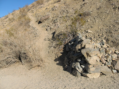
I hike past this cool looking trail but continue up the canyon. If I have time I might just hit this on the way back.

The canyon has some towering rock formations set formed by nature.

And some that are formed by man.

As I continue up the canyon it is easy to see why someone named this after a cathedral. The towering sides enclose you and give you comfort.

At the end of this section of the canyon is a large dry waterfall. There are possibly ways to get around this fall but they would be steep, rocky and potentially dangerous. So this is a good turnaround point.

Heading back you get a good view of Edom Hill and the Little San Bernardino Mtns.

Looks like I'll have time to go and explore this trail, at least for a while.

The trail goes up into the mountains and one trail drops down into another canyon. I take the mountain route.

At the next fork I take what appears to be either a game trail or an old Indian trail and it leads to yet another canyon.

From up here I can look across to Murray Hill and the San Jacinto Mountains.

I also look up and see what appears to be an old mine or prospect of some kind. I will have to go and explore this sometime.

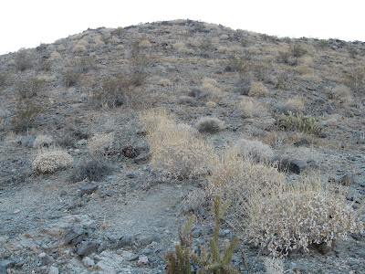
Instead of dropping down I choose to climb up another hill hoping to run into the trail I didn't take at my last intersection.

With the sun setting quickly I hope to run into the trail quickly.

The trail is right where I suspect it is but then I spot something else I don't expect.

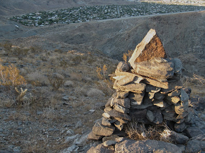
Who put this here? This rock monument is probably twelve feet tall at its longest side and at least nine feet on its shortest. I wonder how long it took to build this thing.

And it's not the only one. There's a second smaller rock pyramid not far away.

I want to explore around a bit more but the sun is going to bed and the wife called and wonders when I'll be home. There are so many mysteries in these hills that I never get tired of going out to discover them. You never know what you're going to stumble upon next.
6 comments:
I expected a picture of the pulpit.
I hiked Cathedral Canyon many times as a boy in the 1950s & `60s. At that time there were pools at the base of the dry falls and in those pools were small fish (maybe Desert Pup Fish).
I know this is an old post but I was just in Eagle Canyon, the Real Cathedral Canyon in the area just further up from the dry waterfall you mentioned. There is still water in the canyon, most in small ponds which aren't very big, and drips that the bees just love. there was one pool that had dozens of tadpoles swimming in it so there are frogs around. Here's a photo looking down the waterfall.
http://www.petermcmahonstudio.com/Photography/Desertandnature/desert/i-rL33rW2/1/L/DSC5557-L.jpg
This is a post about Eagle Canyon. http://hikeeveryday.blogspot.com/2009/11/mcmanus-trail-to-eagle-canyon.html
I know Cathedral Canyon continues from where I stopped at the dry fall but I was interested in exploring the trail that left the canyon and headed toward Rancho Mirage. It's an interesting area back there.
I know this is an older post, but any idea of the height of that dry fall? Been on a canyoneering exploration fix in that area lately, and I think I may have found the next canyon. Two so far, Guadalupe and Bear Creek: http://christianlupercio.com/blog/
I'd say it's 100 feet. I've since learned there's a trail that skirts the fall to the left. It's visible on Google Earth.
Post a Comment