Showing posts with label Santa Rosa Mountains. Show all posts

Monday, December 14, 2009

Sheep Canyon, Santa Rosa Mountains

DAY THREE HUNDRED AND FORTY EIGHT

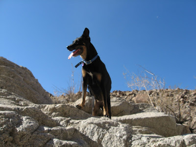
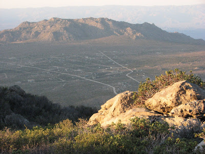
I went today to a place in the Santa Rosa Mountains south of Martinez Canyon that I'd never been to. I figured with a name like Sheep Canyon there was a good chance there might be Bighorn there or something else interesting.

To get to where I'd start hiking I'd have to drive through some orchards and a bit of a garbage dump. It's obvious that someone's been here before.

I head up the canyon looking to see if there might be a trail leaving the wash and heading up toward the hills.

I get past the mud cliffs and find an area to leave the wash and look around. The terrain is not easy to traverse. It's very rocky.

If you don't watch your every step there's a distinct possibility of falling and getting hurt. I get a bit injured and come inches from planting my face on a big boulder. Fortunately, my injuries are minor and I can continue on.

In the midst of a big boulder field, we come upon this nice barren flat.

It's readily obvious that this area has been visited before.
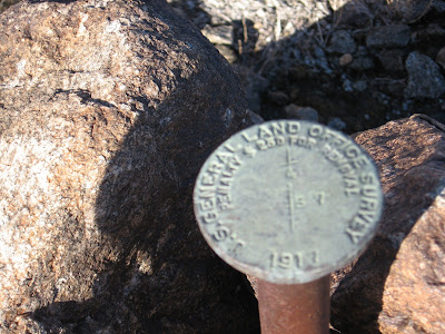
There's a benchmark from the General Land Office, a government agency that ceased to exist over 60 years ago. The date on it says 1917 and there's a good possibility it was put here then.

Looking south I see what I came here to find, a trail.
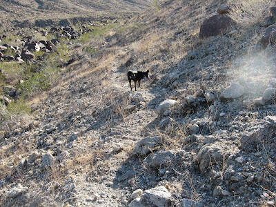
I'm sure there are dozens of trails in these mountains that no one knows about and I intend on finding them all.

The trail heads down to this wash but this is not the canyon I came here to explore today. It looks like there's possibly a palm oasis up there but that'll have to wait for another day.

We head over to Sheep Canyon to give it a little look.

The trail drops right into the canyon and I quickly see why.

The canyon is full of mesquite, a food staple of the Cahuilla Indians.

A bit further up the canyon is this weird looking rock area. It looks almost like concrete that has been weathered. There is lots of indications that Indians lived here.

There are several bedrock mortars all over the top of the rocks.

Some are over a foot deep.

On the south side of the wash is a little area that was obviously a campsite. There are a few fire rings and numerous mesquite bushes all around.

A few trails are up here as well.

It is obvious that someone's spent some time up here since the Indians moved on. I'd like to spend more time looking around but I also want to head up the canyon bit further and see if I can find another trail. I will be back, though.

The canyon has some very interesting geology.

More importantly, both to the wildlife in the area and the Indians back in the day, there's water. The water is flowing very well so there's a good chance that this is spring fed.

There are many sheep droppings near the water and it's evident that this must be a good place to spot either a sheep or other wildlife. At least, some biologists think so.

On the way back to the Jeep I make one more stop at the "concrete slab" to see how many more bedrock mortars I can find.

I count fourteen but there's a possibility there are more since there's some sand from the recent rains. When I come back--and I'm definitely coming back soon--I'm going to bring a little trowel to move some sand around and plan on spending more time. There's a great campsite so I might even plan a backpacking trip. This is one of my new favorite places.

Tuesday, November 10, 2009

The Same But Different

DAY THREE HUNDRED AND FOURTEEN

I get bored doing the same hike over and over again. If I had my way I would do 365 different hikes this year but unfortunately time and money do not allow it so I've had to repeat some hikes. When I have to do this I try to make it a little different by taking someone else along or adding a new section to one I've done before. Today I did both of these, sort of.

I did this trail near my house and took Kahlua along. What was different is that we came back a new way that we've never done before.

We get to the trail junction and take a right.

I'd like to go left again soon and go to the end of some of these canyons. I've been up there but not to the end. I know there's something cool up there, I just know it.

By going to the right I come to a big wash and this will be our return route. I've never done this before so I'm excited to see what's down here.

The wash narrows and heads down this little dry fall.

Kahlua takes one look at it and says, "What are ya, nuts?". I ain't going down that. I call her and grab her collar but she jerks away. I head down alone and figure she'll find her own way.

I had no doubt. That dog is a good route finder.

We get to another section where the wash narrows and goes through some rocks.

I'm kinda worried about this one. I think the fall might be bigger and the detour longer.

I was mistaken about the difficulty. It wasn't nearly as tough as I thought it would be. Kahlua even wonders what's taking me so long. I don't have four legs, OK?


This rock stands out to me because it's almost a perfect cube. I want it in my yard but it's a little too heavy for me to carry home.


It must have stood out to some earlier visitors because I find a pot sherd not far from this rock.

And a few more close by.

As we near the end of our hike we come across these tools and wonder if a mystery trail maker left them here.

It looks like trails aren't what they're interested in but these crazy circles. I figure that's OK because who really needs a trail anyway?

Monday, September 21, 2009

The Crest of Spring

DAY TWO HUNDRED AND SIXTY FOUR

This week will be a tough one for me. Not only will it be hotter than I'd like it to be for this time of year but my work schedule is not going to give me very much time to get out and go places. That's why today I headed up Highway 74 and went exploring behind Spring Crest. I drove the Jeep up about as far as I could and still have a good place to turn around because from the topo map and Google Earth it looks like there's some sort of trail up here. The trail, if it really exists, goes along the face of Santa Rosa Mountain over to the Sawmill Road.

I park and start looking for the trail. I could've continued driving up the road but I wasn't sure if I'd have a good turn around spot.

The trail is not readily evident and if there is one it is very overgrown. Obviously.

Bashing around through the bushes I find this pipe so that's a good sign.

And here's an even better sign. I've reached the Forest Boundary and hopefully will find some semblance of a trail.

I finally find what I'm looking for. It appears to be an old road of some kind.

The road deteriorates and I turn right and start heading up this gully. As long as there are no bushes blocking my path I'll be OK.

There are sections higher up where it appears that this gully was once some sort of road.

At this point, though, it is so eroded that the only way to travel on it would be on foot. The Jeep might be able to make this but it's way beyond my driving skills.

The gully/road is relatively steep and gains elevation quickly. I get nice views looking down upon Pinyon Flats and Asbestos Mountain.

I think about climbing this rock to get a better picture but quickly decide against it.

In order to get on the rock requires me to pass through this brush and I'd prefer to go home with some skin on my legs.

Even without climbing to my preferred perch I can see Sugarloaf Mountain and the Coachella Valley. I'd like to go further but it's time to head back.

Going down that rocky gully in the dark would not be my idea of fun. But once the weather cools down just a little bit more I'd like to take this trail/road all the way across Santa Rosa Mountain. I want to find out why someone would put this here.