Tuesday, November 24, 2009

HIdden Palms The Long Way

DAY THREE HUNDRED AND TWENTY EIGHT

I am starting to get sick.

The wife has been a seething pustule of infection for the past few days and she's been kind enough to share with me. Right now it's just the start of a head cold, sore throat, tired eyes, minor congestion but I'm sure it'll intensify. It's that time of year.

When determining where to hike this afternoon I could either go with a tried and true route or try to mix it up a bit and do something different. I decide on the latter.

Bad choice.

I went to the Coachella Valley Preserve and rather than doing a tried and true route I decide to try something different. The head cold must be affecting my thinking. I hike toward the cliff area and take a right and follow the wash down toward Ramon Road.

Not only am I walking in sand, I am also heading straight into the blinding light of the setting sun. It's OK, though. There's really not much to see.

I get to the end of the hillside and turn left. The signs for the trail take me across more soft sand along Ramon Road. I'm not near done, I only wish I were.

I round the next corner and am about two and a half miles into the hike and come upon the Covered Wagon Tour headquarters.

At this point, my head feels about like this guy's.

I leave the Ranch area and head over to Hidden Palms.

This is a great little oasis and one day I'd like to visit earlier in the day and stay a while, maybe bring a lunch.

Upon leaving the oasis I get on the regular trail and the going is SO much better. I will never again go the way I went today but you never know until you try.

Finishing up with just enough light I check and see that I've done over four miles instead of the usual two miles it takes to get to the Hidden Palms. I guess this just goes to show that more is not always better.

Monday, November 23, 2009

The Ultimate Canyon

THREE HUNDRED AND TWENTY SEVEN

Ladder Canyon in the Mecca Hills is a classic desert hike and a great place to take kids. That's one reason I've taken them there. There are about a million other hikes in the Mecca Hills and there's one hike that I think is perfect for kids. It's interesting, beautiful and not too long.

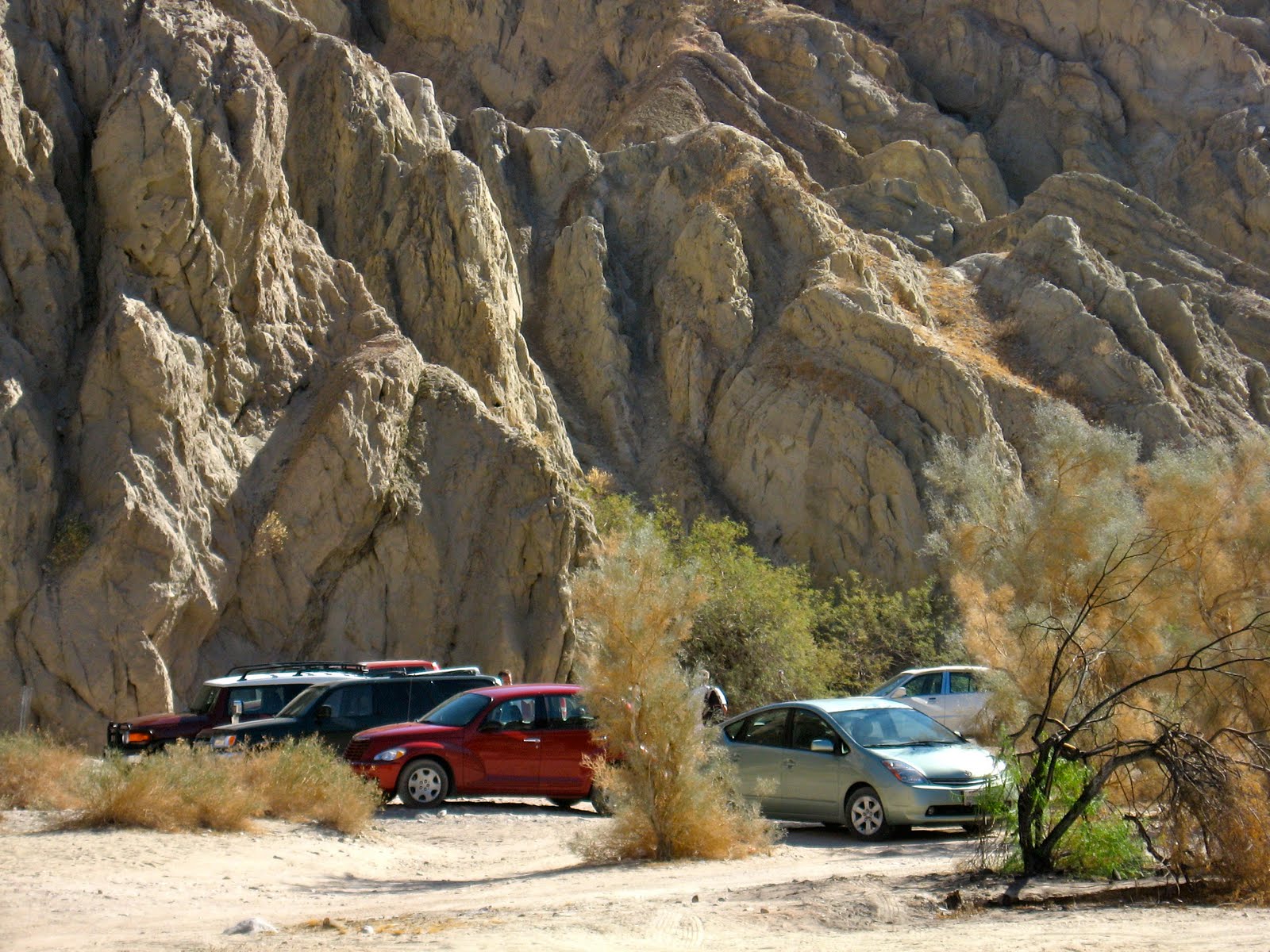
Although the Ultimate Canyon hike starts at the Ladder Canyon parking area it is not very heavily traveled. There were at least 10 cars in the parking area but I was the only one in the canyon when I went there.

Instead of going to the Ladder Canyon or the main canyon to the NW, head to the smaller canyon about 285º NW of the parking area.

The beginning looks like this.

As you get further in the canyon it narrows and the walls are probably 80-100 feet high in sections.

There are fun little passages for kids to run around although I stay in the main canyon. I'll have plenty of passages later.

You'll have this short 4-5 dry fall to climb and then you'll need to take an immediate left.

You'll then come upon this part where the canyon has collapsed upon itself leaving two small places to squeeze through, one low and one high. I choose high but wonder if it's a good idea.

Probably not.

It doesn't get any better from here.

OK, after one more tight squeeze I get to where I can actually see the sky again.

A bit further on is another tight squeeze but I can do this one standing up. Of course, I don't know if I'll be able to fit after dinner on Thanksgiving. It's really tight.

At the end of the canyon is a dry fall about ten feet tall. In another canyon nearby a ladder would be here but nobody's been able to squeeze a ladder back here. It is climbable but one should always remember that it is always much harder to come down something than to climb it. This is a good turnaround spot.

This is but one of tons of little canyons to explore in the Mecca Hills but it's a great one to bring the kids. To them, it will be the Ultimate.

Sunday, November 22, 2009

Fish For Thanksgiving

DAY THREE HUNDRED AND TWENTY SIX

Thanksgiving is coming up so I thought that a lot of families might be wondering what to do with the kids. Take 'em hiking! I'll give you a few suggestions of places that are good for kids. They're not too challenging and they've got something interesting for the kiddies to see and do.

My first suggestion is The Fish Traps out in Thermal. They're easy to get to, the hike is REALLY easy and there's an interesting story to tell.

Getting there: Take Jackson Street, south from Indio to the intersection of Avenue 66. As you near Avenue 66, you'll see a large line on the mountain. This is the old water line from the ancient Lake Cahuilla. About 500 years ago, a large lake filled the entire lower Coachella Valley. It was over 25 times larger than the Salton Sea.

Park on the right side of the road. The location is:
Lat: 33.569345º N
Lon: 116.213714º W

Walk along the fence until you get to the end and then turn right.

About a hundred yards from the fence there are some petroglyphs. In addition to original Indian petroglyphs--like this one--people have put up some of their own. The original petroglyphs are all symbols; the modern ones are mostly names.

Continue walking around the hillside and you'll soon come to the Fish Traps. There are dozens along the hillside of varying depths and sizes. Have the kids count how many Fish Traps they find.

There are tons of pot sherds here. Some, I'm sure, are original and some are more recent.


The Fish Traps are in rows along the hillside.

Some of the Fish Traps are really deep and could hold a whole family.

Others, like this last one, are more pint size.

Just be sure the kids don't take anything with them. Leave everything for someone else's kids to enjoy. Let them know this was here before the first Thanksgiving and is probably the oldest historical site in the Coachella Valley.

Saturday, November 21, 2009

Hiking Down The PCT from Fuller Ridge

DAY THREE HUNDRED AND TWENTY FIVE

Last Tuesday I did my longest hike of the year from Snow Creek to the summit of Mount San Jacinto and then on to the Palm Springs Aerial Tramway. Today a group of about fifteen hikers did the same hike and I went to lend my support. No, I didn't do the hike again--my feet would never forgive me--but I went to bring drinks to a spot 17 miles in and bring a few people back who were not going to do the entire 30+ miles. While I was there I figured I'd go for a little hike down the PCT. I was glad I did because when I was coming up all I looked at was the trail. Now I was able to enjoy the view.

The Fuller Ridge Trailhead is eight miles up the Black Mountain Road right off of Highway 243, west of Idyllwild.

It was cold when I got there in the morning. Cold enough that the small amount of snow on the ground has remained there for over a week.

Heading down the PCT will some bring you to one of the best views in Southern California.

From just a mile down the trail you feel like you can almost reach out and touch Mount San Gorgonio.

Looking a little to the south you can look right into Orange County and Saddleback Mountain. From here, I can look easily into four Southern California counties.

That is, when I'm not enjoying looking at the granite rock formations.

I meet some of the hikers coming up the trail and enjoyed my time meeting them all. Hopefully in the future I'll actually be able to spend some time hiking with them all rather than just being the support crew. But for whatever the reason it was a pleasure to get up in the mountains again and I hope to be able to do it at least once more before the winter rolls in.

Friday, November 20, 2009

Hiking with the Herds

DAY THREE HUNDRED AND TWENTY FOUR

There are days when my hiking choices are limited; today was one of those days. I had to take the kids to school and then only had a short bit of time before I had to head to work. On days like this, when I have to hike a trail I've already done before, I try to mix it up a bit but doing a different combination of trails or canyons. It's boring but even a boring hike is better than most other activities in life.

I went to where the herds hike, behind Target, at the Bump and Grind trailhead. Instead of going up the B&G trail--which to me is a mall walk--I went south along the Hopalong Cassidy Trail. Considering the amount of money they've spent on these trails I would think there might be better signage here.

This is probably one of the best made trails in the desert. It's too bad so many people go the other way on the trail because this way is so much better.

It's not only because of this beautiful rock garden along the trail.

The trail is a single track all the way and is suitable for all members of the family whereas Bump and Grind is just a road.

Also, Bump and Grind doesn't have any of this fantastic hiking art along the way.

I should be careful when I ask for better signage because on some trails there's a tendency to overdo it. On the Herb Jefferies Trail, there are probably eight signs in 1/4 mile from the parking area to the trail.

I hike up the hill again and back to the crowds. A proper trailhead here would do well to show people what other trails are available. I think if people knew, this place wouldn't be nearly as busy.