Saturday, February 28, 2009

You Can't Keep A Good Man Down

Day Fifty Nine

Today my quest to hike every day, and possibly more, almost came to an end but I'll get to that later.

There is no better place on earth than the desert right now. The weather is perfect with warm days and cool evenings and the rain we had a few weeks ago has brought forth vegetation everywhere. I don't know why other people don't hike every day.

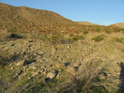
This afternoon, I headed up a trail here in La Quinta that I took with my son and his friend last month. The three of us went up a canyon where there were a couple of water tanks and some dry waterfalls. This time, however, instead of going up the canyon I took a different fork and went up toward a saddle between Coyote Mountain and Indio Mountain.

At this sign, I take the trail to the right and head up toward Coyote-Indio Pass.

There a lots of flowers along the way like these white Forget Me Nots and the purple Notch-leafed Phacelia.

I also spot the first Arizona Lupine that I've seen this year.

The trail is heavily ducked with cairns, which is silly because the trail is easy to follow. One of my hiking pet peeves is the over ducking of obvious trails. I feel it distracts from the hiker's wilderness experience and also robs the novice hiker of the opportunity to learn how to find and follow a trail without assistance. Without the cairn on the right is there really a chance I would miss this trail?

The first Desert Mallow of the season for me.

I get up near the pass and hear the sound of someone moving above me. I look up and see some Desert Bighorn crossing the pass and moving across the mountain. Watching them traverse the hillside for about twenty minutes I am in awe of their balance and strength. It is amazing how easily they navigate the loose, rocky terrain of these Santa Rosa Mountains.
(Click on this, or any, picture to enlarge).
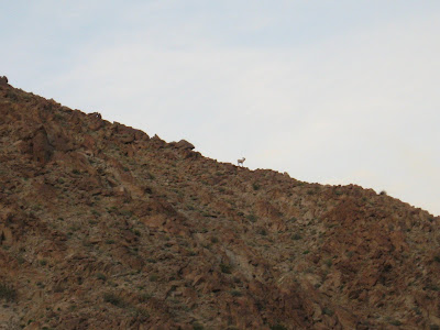
Silhouetted against the desert sky. I am sad today that my camera with 12X optical zoom has to be sent in for repair. This is one day I really would have liked to have had it.

I give up on the idea of making it to the pass today and decide to head back. What could I possibly see up there that would be better than watching those sheep on the mountain? I spot my first Ghost Flower on the way down.

Also, I see this Red Barrel Cactus getting ready to bloom.

If not for a slight mishap on my way down this would have been a perfect hike. As I was heading back to the car, coyotes began to serenade me. Somehow lost in their plaintive chorus and the afterglow of watching the Bighorn, I wasn't paying attention and took a pretty good tumble, probably the worst I have ever taken on a hike. I was coming down the trail on the embankment of a wash and lost my footing. Without any chance of correction, I hurled headfirst down the hillside. Luckily for me a Desert Lavender was there to grab onto and help me slow my plummet.

I stop abruptly as my head hits a boulder and my shoulder slams into the wash bottom. My noggin has about a two inch long divot but no serious damage. It won't need stitches. Like a boxer after a flash knockdown, I jump to my feet to regain my senses. I quickly assess the damage: no blackout, no dizziness, no major pain. I jammed my thumb and abraded my shoulder and forearm but nothing more serious, thank God. I lose my glasses but after a quick prayer manage to locate them. Time to get home. I think about calling my wife but I don't want to freak her out. She'd send the National Guard, the Marines and every Search and Rescue team within 250 miles. I make it to the car without mishap.

After a shower and little ice on my thumb, I feel pretty good. Of course, I might not tomorrow morning but that's what Advil is for. My little mishap is certainly not the ideal way to end my second month of hiking every day but I am happy that until now, except for a few minor scratches, I have been completely injury free. A sprained thumb is no big deal. I'm glad I didn't sprain my ankle.

There is something to be said for being hard headed. Some people might take a tumble like this as an omen and call off their quest but I'll be on the trail tomorrow, albeit a little more cautious, perhaps. I'll stop before I start to daydream from now on.

Life is never going to be perfect and we're all going to take a tumble from time to time but it's not how many times you fall, it's how many you get up, right?

See you on the trail.

Online Interview

There is an interview with me published today in the online journal The Nevada Outdoor News. I know that I don't live in Nevada but I'm in a desert; they're in a desert; so a lot of the experiences I have relate to them.

Besides, now that I've had this interview published in their journal I feel obligated to go to Nevada and do some hiking. Maybe on long weekend I can hit Mount Charleston, Red Rocks and Grapevine Canyon and follow it up to a trip to the Spa at the Ritz Carlton at Lake Las Vegas. I need a pedicure badly.

Read the interview and learn about fun outdoor things to do in Nevada. My little sister just went hiking at Red Rocks and dug it.

Friday, February 27, 2009

Tourist Town

Day Fifty Eight

There are certain hiking related injuries that are common to people who hike a lot: sprained ankles, sore knees, cuts and scratches and chafing. This morning I was suffering from chafing--oddly enough from my work uniform and not from hiking--so I decided to go on an easy hike, a tourist trail.

I've done most of the trails out here. Most of the hard ones, that is. What I've neglected over the years have been those easy trails of a couple of miles or less. I'm now learning what I've missed.

Today I went on the Randall Henderson Trail. This trail starts at the Santa Rosa San Jacinto National Monument Visitor's Center in south Palm Desert.

The Visitor's Center is right across Highway 74 from the Art Smith Trailhead

The trail starts by this highly reflective plaque with a wonderful quote from Randall Henderson, founder of Desert Magazine.

Dogs are not permitted on this trail, which is kind of ironic considering that the trail was constructed with dogs in mind. However, the Bighorn Institute, which is adjacent to the trail property, objected and so you now have to leave Fido at home.

The trail splits after a short while but it doesn't really matter which way you go because it is a loop.

The Chuparosa was everywhere along the trail in addition to about ten other flowers in various phases of blooming.

I saw these Desert Poppies.

Some Desert Chicory

Several cacti just budding and getting ready to blossom like this Hedgehog.

And this Beavertail.

Just before getting back to the Visitor's Center I spotted this lone cactus in bloom. It is the first cactus I have seen flowering so far this year although it is obvious there will be many, many more.

There is much to be said for this little mile and a half trail right off of Highway 74. Being that it's a tourist trail, I had the opportunity to hike with some tourists, a terrific couple from Minnesota and their friend, originally from Minnesota, who's from Palos Verdes. We talked about the plants, the weather, the desert and our appreciation for nature. They told me that they'd gone to Joshua Tree and the 1000 Palms Oasis.

It made me think of friends of mine who, growing up here their entire lives, have never been to those places. It never ceases to amaze me that people will travel thousands of miles to visit places that we take for granted. I realized that we'd all do well to be tourists in our own backyards a little more often. It might help us realize how lucky we are to be living in what Randall Henderson called, "The Real Desert".

Thursday, February 26, 2009

Unplanned Parenthood

Day Fifty Seven
I had plans for a nice hike up Hwy 74 today but sometimes life gets in the way of your plans. My wife informed me last night that I was accompanying my son's class on a field trip to the Palm Springs Desert Art Museum and, oh yeah, I was driving. Asked why she didn't go since it was her day off, she replied that she hadn't signed up with the district for approval and I had.

OK. Dad duty overrules plan so now it's time for new plan.

I decide to go do a hike South of Lake Cahuilla, in some canyons I had been eyeing. To get there, I had to hike along the southern wall of the Quarry Golf Club. Next time, I'll drive a bit further. This part of the hike is not very interesting.

There is some landscaping going on in this area outside the club. It'll be good to remember there's water here once it starts getting hot.

I head up a wash, south of the club, with Martinez Mountain looming in the background.

I quickly notice this trail on the right and decide to take it.

From the trail, you get a nice view of Lake Cahuilla, some homes and the golf course.

A bit further on the trail I can look down about a hundred feet into the canyon bottom.

As the trail reconnects with the canyon, I decide to take a right and hike cross country toward another large canyon.

This canyon is deep and looks like a giant sluiceway. I'd love to explore it but I have a museum to go to so I must turn back here.

I decide to hike the canyon back to the start rather than take the trail. It is easy to see that the trail was built solely for the use of equestrians because the trail is quite passable for someone on foot. A horse, however, would have a bit of a problem coming down some of the obstructions in this canyon.

There are a couple of other canyons in this area to explore so I'll have to add them to my plans.

Wednesday, February 25, 2009

Indian This and Palms That

Day Fifty Six

It seems almost everything out here has the term Indian or Palms in it. OK, you can probably add the terms desert, spring, oasis, valley or canyon to cover everything. Considering that, I went on the perfect desert hike today. It was the Indian Palms Oasis. It is in a little canyon fed by a spring on the North side of the valley.

You leave from the parking lot of the 1000 Palms Oasis. Today that lot was filled with cars from places much colder then here. Oregon, Washington, Canada, Iowa and New York were all represented. A few Californians were even there. They were probably from up North.

It's very easy to get to the Indian Palm Oasis. Just follow the signs.

I didn't see any evidence of Indian inhabitation like metates, arrowheads, bedrock mortars or casinos but it's easy to see why Indians may have used this area. Mesquite was a staple of the Cahuilla diet about a hundred years ago and there is a lot of it growing here.

Here is a beautiful full skirted Washingtonian filifera, California Fan Palm. Mesquite and palms are both indicators that water is just below the surface. Both require constant water to survive, especially the palm trees, which have shallow roots.

Here are some not so beautiful headless palms.

I found a lot of evidence of more recent inhabitation and some historical litter. That's a fancy name for old junk left by someone a long time ago.

If you're looking for an easy, nice hike to take someone visiting from another state or country, the Indian Palm Oasis, shown with Mount San Jacinto in the background, just might be a perfect choice.

Tuesday, February 24, 2009

Secret Pathway

Day Fifty Five
Today I had to call in a favor. Last month, I went to hike an old Indian Trail that goes between Indian Wells and La Quinta. I was unable to complete the hike due to obstructions called gated communities. Through a personal connection I was able to gain access and go on my hike. Don't ask for the number, though. The homeowners association would probably have a fit if a bunch of hikers came traipsing through their private community. Hikers are sweaty, have dirt of their bodies and might wear shirts without collars. I had to pretend I wasn't a hiker. I told them my name was Biff.

You park near this cave in the side of the mountain. Its location is top secret.

I hike behind the homes until I come to the location of the trail

It is marked with this sign. I'm glad the sign is still here. There was a rock that had a bedrock mortar in it years ago but it is now gone, the victim of development. Hopefully, it's in the Historical Society Museum and not some dude's backyard.

The trail rises sharply and steeply. Actually, there are two trails which intermingle as they go up the hill. One is the original Indian Trail and the other, a reworking of it to make it not so steep. Personally, I prefer the steep trail. Those Indian Trails were no nonsense.

At the top of the trail there are two good size trail monuments.

Looking down into Indian Wells.

I get to the bottom near the golf course and decide to look around for any signs of Indian inhabitation, like bedrock mortars or pot sherds. I know the Cahuilla had a village site at the base of this trail but the remnants of it are probably under the golf course. However, the golf course has a nice little monument to the Indians, the Indians of the Pacific Northwest, that is.

While scouting around I see an area that's not been developed, which seems weird, and walk around there a bit. I quickly notice this huge rock monument. It must be over seven feet tall. I can't be sure but it looks like something the Indians may have built. I'll have to check with the city, maybe someone there knows. It would explain why this land was never developed.

This arrow shaped rock on the top of the monument is a nice touch.

There is also a large rock circle on the ground which often signifies a grave site.

And up on the hill, I spot this hunting blind.

Unfortunately, I didn't call my friend who lives in this country club and so I don't have permission to be here today. I'm going to high tail it back to La Quinta before the golf ranger comes and throws me out. But if anyone reported somebody walking around the golf course today, just remember: the name is Biff.

Monday, February 23, 2009

All in a Day's Work

Day Fifty Four
Today I had a day off and was looking forward to a nice, long hike. On the way to dropping off my son at school, a friend called and asked if I could pick up her son after school because she had to go to the doctor. Not a problem, I told her.

Yes, I will be going on nice, long hike. Just not today.

I decide to hike down to Horse Thief Creek. It's a nice little hike in the Santa Rosa Mountains about fifteen miles from Palm Desert. According to John Robinson in his book, San Bernardino Mountain Trails, this area was used by horse thieves who stole horses in San Diego, brought them out to this area, rebranded them and sold them in San Bernardino. They then re-stole them and did it again in reverse.

There are a number to great places to hike to up here. I will be going up to Cactus Spring and doing a little exploring looking for Indian history. Yes, I will. Just not today.

You soon hike by this old Dolomite Mine. You cross your first creek right near this mine. With the snow in the mountains melting, there were several little creek crossings.

This sign serves as a warning to the unprepared. Let's see what I have today. I have two bottles of water although one is only half full. I have an iPod full of rocking tunes. I put sunscreen on before I left my vehicle and I have shoes on. I'm prepared!

Before arriving at Horse Thief Creek, I see this nice little waterfall. I've noticed this fall a number of times and one day I'm going to hike up to it for a closer look. Just not today.

There is a fair amount of water in Horse Thief. Upstream about a mile there's a nice little waterfall that I'll get some pictures of. Just not today.

Above the creek are the remnants of an old corral left by the horse thieves or some cattlemen or some hikers who brought their kids and wanted some peace.

On the trail out I get a good view of Sugarloaf Mountain, which rises above Pinyon Flat. I am going to be climbing this. Just not today.

Leaving, I get a picture of Martinez Mountain. I've climbed this peak several times and it's one of my favorites in the desert. I look forward to climbing it again. Just not today.

There are so many things to do and see in the Santa Rosas that it's impossible to do all of them in one day. I'm looking forward to coming back and visiting over and over and over again. But today, I have plans.